GROUND DATA
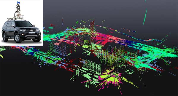
On the street, GeoSim’s data-capture vehicles encode the urban landscape in great detail. Rather than gathering data on the fly from moving vehicles, GeoSim employs a stop-scan methodology. The vehicle operating system guides the driver to follow the preplanned routes for every street in the city, signaling each stop point and automating the 90-second data gathering process. These fixed scanning positions increase spatial accuracy by more than an order of magnitude as compared with data gathered from conventional moving scanners.
INDOOR SPACE
A proprietary indoor data collection device captures high-fidelity interiors that are fully integrated with the city exteriors, while doubling spatial accuracy and refining visual resolution down to the level of millimeters. These interiors have high visual fidelity and are also parametric, enabling retail locations give consumers full interaction with product inventory.
PREPROCESSING
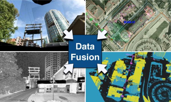
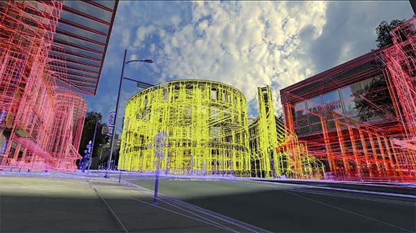
Data preprocessing fuses four primary inputs: aerial LiDAR and photography, and ground LiDAR and photography. GeoSim is the only company to have successfully automated city-scale data fusion, rapidly and precisely merging high-resolution aerial data and ground data. A key technology required in this process is GeoSim’s patented capability to resolve the frequent problem of GPS ‘blackout’ areas in city street canyons. In addition, GeoSim has developed proprietary means to automatically convert the merged set of geo-referenced laser point clouds into polygonal 3D geometry.
3D MODELING
GeoSim’s 3D modeling is based on Autodesk 3D Studio MAX, augmented with numerous proprietary plug-ins and several stand-alone mapping applications. Precise configuration control and data management are essential in the construction of a city-scale 3D model. GeoSim’s fourth-generation production software streamlines these processes, maintaining rigorous process and quality control while coordinating the assignment and monitoring of modeling tasks at remote production facilities.
The entire process is globally scalable, including GeoSim’s integrated security software.


